Koh Kong
The dangers posed by the Khmer Rouge, coupled with the difficult journey through the Cardamom Mountains, led to Koh Kong being neglected for years. Accessible only by sea and air till 2001, its
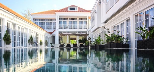
 fortunes are now changing thanks to a road that links the town to the NH4 and to the rest of the country. The town has built up its accommodations and dining options to cater to the increased influx of tourists from Thailand – the border is just 6 miles (10 km) away. Koh Kong is a good
base for ecotourism; trips up jungle-fringed rivers and through mangrove forests can be organized from here. About an hour upriver from Koh Kong, Koh Por Waterfall has a gorgeous rain forest
setting. There is safe swimming below the falls, but visitors should be careful above the main drop as currents can be strong after heavy rain. Between December and June, hiking is possible on trails
along the riverbank. Environs Near the Thai border, Koh Kong Safari World, with its numerous shows featuring a variety of animals, can be a fun excursion for the family.
Peam Krasaop
Nature Reserve Road Map B7. 4 miles (6 km) S of Koh Kong. Covering 93 sq miles (240 sq km), Peam Krasaop Nature Reserve is one of the most Tatai Waterfalls 6 Road Map C7. 12 miles (19 km)
E of Koh Kong. from Koh Kong. Set amid lush green jungle, the picturesque Tatai Waterfalls lie upstream from the bridge spanning the Tatai River. During the rainy season, the falls have powerful rapids, while the dry season presents opportunities for dips in rocky pools. Visitors can reach the
falls by kayak, hiking trails, or boat, as well as by motos that can be hired from Koh Kong. Nearby, along the near-pristine Tatai River, are two excellent ecolodges.important mangrove environments in Southeast Asia.
The mangroves not only protect the coastline from erosion but also support a wealth of flora and fauna.
The extensive mud flats here provide a crucial habitat for invertebrates and a rich feeding ground for waders such as the spotted greenshank and Asian dowitcher. Concrete walkways have been constructed through the forest, allowing visitors a closer look at the wildlife, which includes mud crabs, storks, and cranes.
The preserve is also home to pangolins, monkeys, bats, and deer. Fishermen have also reported occasional sightings of saltwater crocodiles. A 49-ft (15-m) high lookout tower in the settle ment of Boeng Kayak, at the main gateway to the preserve, offers excellent views of the estuary and mud flats.
Boats can be hired for trips into Koh Kong Bay at the entrance gate, and early morning trips might provide the best chance to spot the Irrawaddy dolphin.
Koh Kong Island
Road Map B7. 16 miles (26 km) S of Koh Kong. from Koh Kong. A tropical paradise as yet
unspoiled by development, Koh Kong Island features beaches lined with coconut palms and other vegetation. Its pellucid waters and pale, powdery sands form seven perfect beaches, although
Beach Three, backed by a lovely lagoon, is the one to head for. This is a blissfully peaceful environment, an idyllic virgin beach where only the wind, the waves, and bird song interrupt the silence. Several species of sea turtle nest here, but visitors are unlikely to encounter them as
they usually arrive at night. Snorkeling is good, with excellent visibility and clear views of schools of mirror fish.
There is no regular transport to Koh Kong Island and visitors will need to organize
a boat trip from Koh Kong, and register at the island’s Cardamom Mountains Road Map C7. 73 miles (119 km) SE of Koh Kong. from Koh Kong. The largest wilderness in
mainland Southeast Asia, the Cardamom Mountains cover an area of 3,900 sq miles (10,100 sq km). Two regions in these mountains have been declared protected – the Central Cardamom Reserve,
which extends over an area of 1,549 sq miles (4,013 sq km), up to Pursat province; and the Southern Cardamom Reserve, covering 557 sq miles (1,443 sq km) east of Koh Kong.
These mountains sustain several distinct forest environments and a wide variety of wildlife. Lower
elevations, which are dominated by dry forests and deciduous trees, support large numbers of mammals, including the elephant, tiger, and sambhar deer. This region is also one of the last remaining homes of the Siamese crocodile. Rain forests at higher altitudes are prime territory for endemic species such as the Cardamom banded gecko. Around 1,400 bird species have also been
recorded here. However, police checkpoint before hitting the beaches. The traveling time to Beach Three by speedboat is 75 minutes.
Long-tail boats, on the other hand, take around 2 hours and 45 minutes. It is advisablem to carry insect repellant because sandflies can be a nuisance here activities such as hunting, illegal logging, and land clearance are putting tremendous pressure on these habitats.
Koh Kong tour operators can help visitors plan trips to the foothills of the Southern
Cardamoms. An ecotourism program has been established at Chi Phat village, 13 miles (21 km) upriver from the riverside port of Anduong Tuek, 61 miles (98 km) south of Koh Kong. It offers
mountainbiking, hiking, and bird-watching. Local guides trained by Wildlife Alliance, an NGO,
organize boat trips to the Chhay Tameas rapids, 4 miles (6 km) from Chi Phat. Visitors are most likely to spot troupes of long-tailed macaques and plenty of birdlife. Another option is the remote park
station at Thma Bang, a 2-hour drive west of the Tatai River, with basic accommo-
dations. Rangers here can organize rain forest hikes, along with local guides.
Botum Sakor National Park
Road Map C7. 63 miles (102 km)
S of Koh Kong. Sihanoukville (034)-933-894. 7am–5pm daily. Occupying the bulbous peninsula between Koh Kong and Sihanoukville, the Botum Sakor National Park encom-passes 707 sq miles (1,832 sq km) of coastal land and low-lying rain forests, grasslands, and mangroves. The park is home to the elephant, fishing cat, sun bear, leopard, and pileated gibbon. Leopards and elephants are rarely spot ted but there is still plenty to see, particularly reptiles and amphibians such as tree frogs, and birds such as the white bellied sea eagle. The park has been a bone of contention between developers and environmentalists, with the former eyeing the fine sandy beaches on the western peninsula.
Environmentalists counter that these plans are contrary to Botum’s status as a national park and
hence disastrous for its wildlife. Despite this, large areas of mangroves have been logged.
There is limited road access to the park, but hikes and boat trips can be organized from the park headquarters, 2 miles (3 km) west of Anduong Tuek. These boat trips pass through mangrove forests teeming with mud crabs and kingfishers.